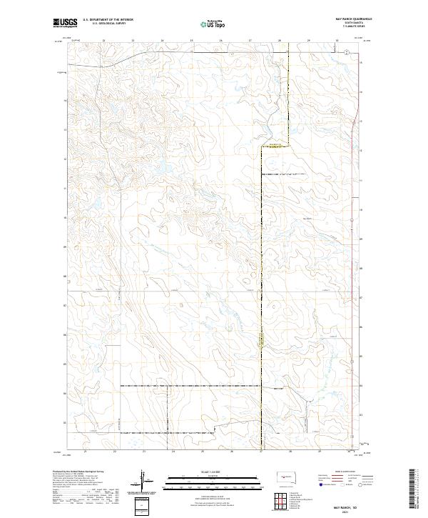
2021 Map of May Ranch
USGS Topo · Published 2021About this map
May Ranch sits as the central point of interest in this cattle-country landscape along the border of Haakon and Stanley Counties. The terrain is defined by the dendritic drainage patterns of Cottonwood Cr and Big Prairie Dog Cr, which carve through the high plains toward the east and north. In the early 21st century, the area remains deeply rural, with a grid of section lines and gravel paths like Dusty Ridge Rd and 249th Ave providing the only terrestrial structure across the rolling grasslands. The mapping of township and range lines, including t4n r24e and t5n r25e, highlights the enduring Public Land Survey System that governs this expansive South Dakota range land.
Find a feature on this map
17 named features on this map. Tap any name to fly to it.
Don’t see what you’re looking for? This feature index may not catch every label — zoom into the map to look around manually.
Map Details
Editions of this 2021 May Ranch Map
This is the sole edition of this map. No revisions or reprints were ever made.
Other maps of this area

1954 · Pierre
USGS Topo · 1:250,000

1958 · Pierre
USGS Topo · 1:250,000

1982 · Hayes South
USGS Topo · 1:24,000
1982 · Midland NE
USGS Topo · 1:24,000

1982 · Midland NW
USGS Topo · 1:24,000

1982 · May Ranch
USGS Topo · 1:24,000

1983 · Bentley Ranch
USGS Topo · 1:24,000

1983 · Hayes North
USGS Topo · 1:24,000

1983 · Philip
USGS Topo · 1:100,000

1983 · Moenville
USGS Topo · 1:24,000