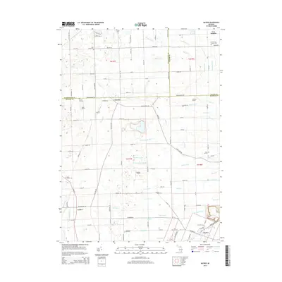
2014 Map of Maybee
USGS Topo · Published 2014About this map
Maybee and the village of London anchor the southern reaches of this landscape where Wayne, Washtenaw, and Monroe counties meet. The area is defined by a dense network of agricultural drainage channels, including the Big Marsh Drain, Raisin Drain, and Herkimer Drain, which manage the low-lying terrain surrounding the Saline River. Small rural settlements like Oakville and West Sumpter are linked by a grid of named section roads, such as Tuttle Hill Rd and Oakville Waltz Rd. Local history is preserved in numerous burial grounds, from the London Township Cem to the Saint Josephs Cem in the north. The presence of several small airfields, including Johnston Airport, Laszlo Airport, and Maybee Airport, suggests a legacy of general aviation integrated into the farming community, while the various branches of Sandy Cr and Stony Cr illustrate the natural hydrography before extensive channelization.
Find a feature on this map
110 named features on this map. Tap any name to fly to it.
Don’t see what you’re looking for? This feature index may not catch every label — zoom into the map to look around manually.
Map Details
Editions of this 2014 Maybee Map
This is the sole edition of this map. No revisions or reprints were ever made.
Other maps of this area

1902 · Ypsilanti
USGS Topo · 1:62,500

1904 · Ann Arbor
USGS Topo · 1:125,000

1906 · Ypsilanti
USGS Topo · 1:62,500

1906 · Romulus
USGS Topo · 1:62,500

1908 · Ann Arbor
USGS Topo · 1:125,000

1912 · Monroe
USGS Topo · 1:62,500

1912 · Dundee
USGS Topo · 1:62,500

1914 · Monroe
USGS Topo · 1:62,500

1926 · Dundee
USGS Topo · 1:62,500

1927 · Monroe
USGS Topo · 1:31,680
Featured Places
- Sumpter Township, MI
- Augusta Charter Township, MI
- Exeter Township, MI
- London, London Township
- London Township, MI