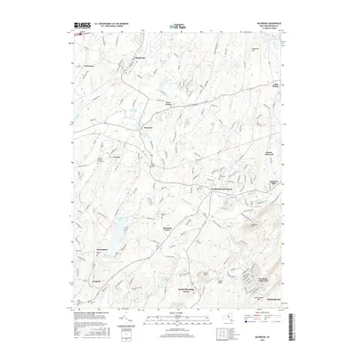
2016 Map of Maybrook
USGS Topo · Published 2016About this map
Washingtonville serves as the central hub of this Orange County landscape, situated where the Moodna Creek and Cromline Creek drainage systems converge. The terrain is defined by a series of prominent rises including Woodcock Hill, Round Hill, and the northern reaches of Schunnemunk Mtn, which overlook a network of valley settlements such as Blooming Grove and South Blooming Grove. For genealogists and local historians, the sheet is exceptionally detailed in its documentation of burial grounds, preserving the locations of numerous family and religious sites like Sears Cem, Woodhull Cem, and Saint Marys Cem. The transportation corridors are well-defined, following the natural valleys and the path of the M & U RR. Small hamlets and residential clusters like Rock Tavern, Burnside, and Farmingdale are connected by a web of named local roads, reflecting the established rural and suburban character of this region west of the Hudson River.
Find a feature on this map
174 named features on this map. Tap any name to fly to it.
Don’t see what you’re looking for? This feature index may not catch every label — zoom into the map to look around manually.
Map Details
Editions of this 2016 Maybrook Map
This is the sole edition of this map. No revisions or reprints were ever made.
Other maps of this area

1902 · Schunemunk
USGS Topo · 1:62,500

1903 · Newburg
USGS Topo · 1:62,500

1904 · Ellenville
USGS Topo · 1:62,500

1906 · Ellenville
USGS Topo · 1:62,500

1906 · Goshen
USGS Topo · 1:62,500

1908 · Goshen
USGS Topo · 1:62,500

1930 · Schunemunk
USGS Topo · 1:48,000

1935 · Schunemunk
USGS Topo · 1:62,500

1938 · Goshen
USGS Topo · 1:62,500

1942 · Goshen
USGS Topo · 1:24,000