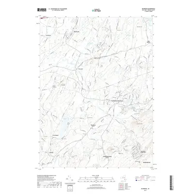
2019 Map of Maybrook
USGS Topo · Published 2019About this map
Washingtonville and Maybrook serve as focal points for this Orange County landscape, where the winding courses of Moodna Creek and Otter Kill dictate the local geography. The area is dense with genealogical interest, containing numerous small burial grounds and family-named cemeteries such as Woodhull Cem, Sears Cem, and the Heard Cem near Blooming Grove. The southeastern corner transitions into the more elevated terrain of Schunnemunk Mtn, overlooking the community of Mountain Lodge Park and the high-altitude Merriewold Lake. Numerous recreational trails, including the Windsor Trail and V Notch Trail, lace through the hills north of Rock Tavern, while legacy hamlets like Neelytown and Little Britain reflect the long-standing agricultural and residential patterns of the region south of Buchanan Hill.
Find a feature on this map
195 named features on this map. Tap any name to fly to it.
Don’t see what you’re looking for? This feature index may not catch every label — zoom into the map to look around manually.
Map Details
Editions of this 2019 Maybrook Map
This is the sole edition of this map. No revisions or reprints were ever made.
Other maps of this area

1902 · Schunemunk
USGS Topo · 1:62,500

1903 · Newburg
USGS Topo · 1:62,500

1904 · Ellenville
USGS Topo · 1:62,500

1906 · Ellenville
USGS Topo · 1:62,500

1906 · Goshen
USGS Topo · 1:62,500

1908 · Goshen
USGS Topo · 1:62,500

1930 · Schunemunk
USGS Topo · 1:48,000

1935 · Schunemunk
USGS Topo · 1:62,500

1938 · Goshen
USGS Topo · 1:62,500

1942 · Goshen
USGS Topo · 1:24,000