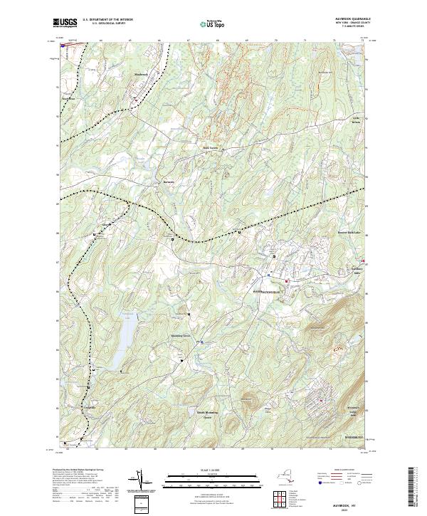
2023 Map of Maybrook
USGS Topo · Published 2023About this map
Washingtonville and Blooming Grove serve as central hubs in this area of Orange County, where the landscape is defined by the winding course of Moodna Creek and its many tributaries. The settlement pattern reveals a transition from traditional village centers to the residential pockets of Mountain Lodge Park and South Blooming Grove. Significant genealogical resources are scattered throughout the territory, including family and parish burial grounds such as Woodhull Cem, Sears Cem, and Bull Cem.
Find a feature on this map
205 named features on this map. Tap any name to fly to it.
Don’t see what you’re looking for? This feature index may not catch every label — zoom into the map to look around manually.
Map Details
Editions of this 2023 Maybrook Map
This is the sole edition of this map. No revisions or reprints were ever made.
Other maps of this area

1902 · Schunemunk
USGS Topo · 1:62,500

1903 · Newburg
USGS Topo · 1:62,500

1904 · Ellenville
USGS Topo · 1:62,500

1906 · Ellenville
USGS Topo · 1:62,500

1906 · Goshen
USGS Topo · 1:62,500

1908 · Goshen
USGS Topo · 1:62,500

1930 · Schunemunk
USGS Topo · 1:48,000

1935 · Schunemunk
USGS Topo · 1:62,500

1938 · Goshen
USGS Topo · 1:62,500

1942 · Goshen
USGS Topo · 1:24,000