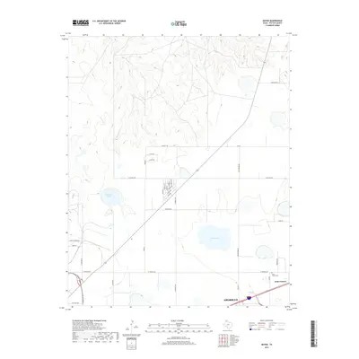
2019 Map of Mayer
USGS Topo · Published 2019About this map
Saint Francis occupies the southeastern corner of this Texas High Plains landscape, situated just north of the expanding reach of Amarillo. The area is characterized by a transition from organized agricultural sections and residential development to the natural drainages of the Canadian River watershed. Water features like Stalanaker Lake and McGee Lake punctuate the flat terrain, while the northern portion of the sheet reveals more complex topography where Bonita Cr and Rosita Cr have carved through the plains. For genealogists and local historians, the Saint Francis Cem provides a specific point of interest near the settlement center. The road network, including FM 1912 and FM 245, reflects the grid-based land division typical of the Panhandle, supporting a mix of ranching operations and suburban growth north of the city.
Find a feature on this map
35 named features on this map. Tap any name to fly to it.
Don’t see what you’re looking for? This feature index may not catch every label — zoom into the map to look around manually.
Map Details
Editions of this 2019 Mayer Map
This is the sole edition of this map. No revisions or reprints were ever made.
Other maps of this area

1934 · Cliffside
USGS Topo · 1:62,500

1936 · Cliffside
USGS Topo · 1:62,500

1953 · Chunky
USGS Topo · 1:24,000

1953 · Pleasant Valley
USGS Topo · 1:24,000

1953 · Mayer
USGS Topo · 1:24,000

1953 · Pomeroy
USGS Topo · 1:24,000

1953 · Berry Sand Draw
USGS Topo · 1:24,000

1953 · Sevenmile Basin
USGS Topo · 1:24,000

1954 · Amarillo
USGS Topo · 1:250,000

1956 · Amarillo East
USGS Topo · 1:24,000