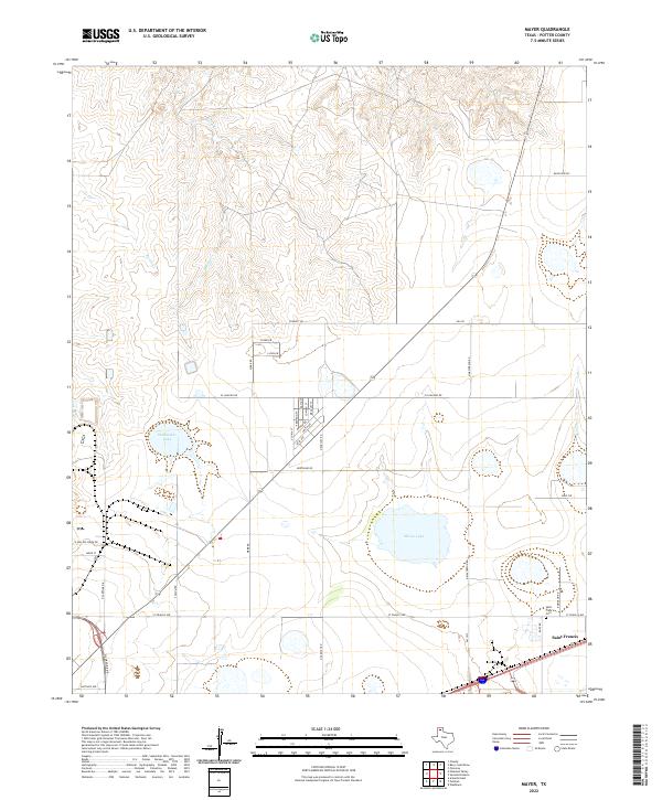
2022 Map of Mayer
USGS Topo · Published 2022About this map
Saint Francis and its surrounding agricultural lands define this section of Potter County, captured during a period of steady residential and rural development. The landscape is marked by several significant water bodies and drainage systems, including Stalanaker Lake, McGee Lake, and the winding paths of Bonita Cr and Rosita Cr. These features indicate the hydrology of the High Plains, where surface water often collects in playas or follows ephemeral creek beds. A grid of county roads and residential streets, such as Stinnett Rd and El Rancho Rd, connects the scattered farmsteads and small developments to the regional network.
Find a feature on this map
33 named features on this map. Tap any name to fly to it.
Don’t see what you’re looking for? This feature index may not catch every label — zoom into the map to look around manually.
Map Details
Editions of this 2022 Mayer Map
This is the sole edition of this map. No revisions or reprints were ever made.
Other maps of this area

1934 · Cliffside
USGS Topo · 1:62,500

1936 · Cliffside
USGS Topo · 1:62,500

1953 · Chunky
USGS Topo · 1:24,000

1953 · Pleasant Valley
USGS Topo · 1:24,000

1953 · Mayer
USGS Topo · 1:24,000

1953 · Pomeroy
USGS Topo · 1:24,000

1953 · Berry Sand Draw
USGS Topo · 1:24,000

1953 · Sevenmile Basin
USGS Topo · 1:24,000

1954 · Amarillo
USGS Topo · 1:250,000

1956 · Amarillo East
USGS Topo · 1:24,000