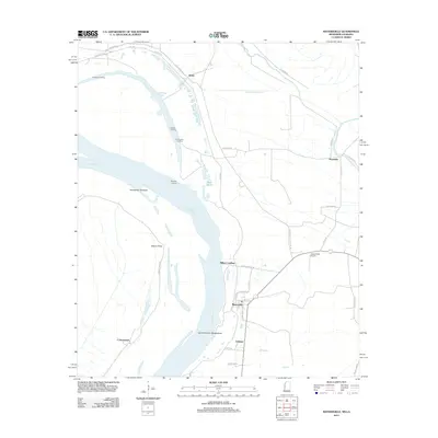
2012 Map of Mayersville
USGS Topo · Published 2012About this map
Mayersville and the winding reaches of the Mississippi River anchor this Issaquena County landscape at the turn of the decade. The area is defined by its relationship with the water, where land features like Island Number Ninetythree and the Duncansby Towhead illustrate the shifting nature of the river channel. Inland, the map reveals a network of small settlements and river-adjacent sites including Addie, Ashland, and Cottonwood.
Find a feature on this map
42 named features on this map. Tap any name to fly to it.
Don’t see what you’re looking for? This feature index may not catch every label — zoom into the map to look around manually.
Map Details
Editions of this 2012 Mayersville Map
This is the sole edition of this map. No revisions or reprints were ever made.
Other maps of this area

1909 · Lake Providence
USGS Topo · 1:24,000

1909 · Wilsons Point
USGS Topo · 1:24,000

1909 · Millikin
USGS Topo · 1:24,000

1911 · Lake Providence
USGS Topo · 1:31,680

1913 · Wilson Point
USGS Topo · 1:31,680

1939 · Lorenzen
USGS Topo · 1:62,500

1939 · Readland
USGS Topo · 1:62,500

1939 · Mayersville
USGS Topo · 1:62,500

1939 · Swan Lake
USGS Topo · 1:62,500

1953 · Greenwood
USGS Topo · 1:250,000