2020 Map of Mayersville
USGS Topo · Published 2020About this map
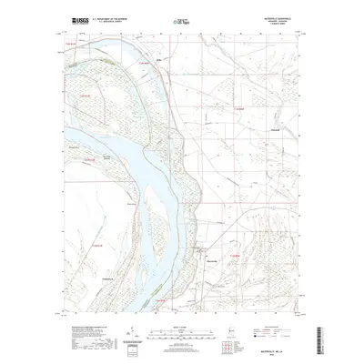
The Mississippi River carves a complex path through this section of the Delta, defining the boundary between Mississippi and Louisiana. The river's influence is evident in the numerous chutes and points, including Opossum Point and Wilson Point, which frame the shifting landscape of islands like Duncansby Towhead. On the Mississippi bank, the town of Mayersville serves as a focal point, anchored by the Issaquena County Courthouse. This riverfront settlement pattern is complemented by smaller hamlets like Addie and Hopedale, connected by a network of rural roads such as Mayersville-Glenallen Rd.
Find a feature on this map
56 named features on this map. Tap any name to fly to it.
Don’t see what you’re looking for? This feature index may not catch every label — zoom into the map to look around manually.
Map Details
Editions of this 2020 Mayersville Map
This is the sole edition of this map. No revisions or reprints were ever made.
Other maps of this area

1909 · Lake Providence
USGS Topo · 1:24,000

1909 · Wilsons Point
USGS Topo · 1:24,000

1909 · Millikin
USGS Topo · 1:24,000

1911 · Lake Providence
USGS Topo · 1:31,680

1913 · Wilson Point
USGS Topo · 1:31,680

1939 · Lorenzen
USGS Topo · 1:62,500

1939 · Readland
USGS Topo · 1:62,500

1939 · Mayersville
USGS Topo · 1:62,500

1939 · Swan Lake
USGS Topo · 1:62,500

1953 · Greenwood
USGS Topo · 1:250,000