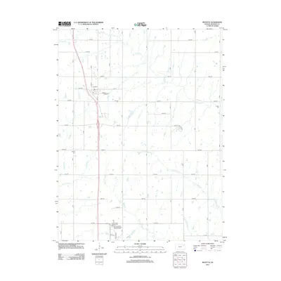
2012 Map of Mayetta
USGS Topo · Published 2012About this map
The settlement of Mayetta serves as the central hub of this Kansas landscape, situated where local drainage patterns define the geography of Jackson County. A network of waterways including Big Elm Cr, Little Elm Cr, and the several branches of Muddy Creek—comprising the W Fork Muddy Cr, E Fork Muddy Cr, and Middle Fork Muddy Cr—cut through the terrain. These natural features dictated the placement of early infrastructure and small rural clusters.
Find a feature on this map
35 named features on this map. Tap any name to fly to it.
Don’t see what you’re looking for? This feature index may not catch every label — zoom into the map to look around manually.
Map Details
Editions of this 2012 Mayetta Map
This is the sole edition of this map. No revisions or reprints were ever made.
Other maps of this area

1889 · Topeka
USGS Topo · 1:125,000

1894 · Topeka
USGS Topo · 1:125,000

1950 · Kansas City
USGS Topo · 1:250,000

1952 · Elmont
USGS Topo · 1:24,000

1952 · Grove
USGS Topo · 1:24,000
1952 · Meriden
USGS Topo · 1:24,000

1954 · Kansas City
USGS Topo · 1:250,000

1956 · Kansas City
USGS Topo · 1:250,000

1960 · Kansas City
USGS Topo · 1:250,000
1960 · Mayetta
USGS Topo · 1:24,000