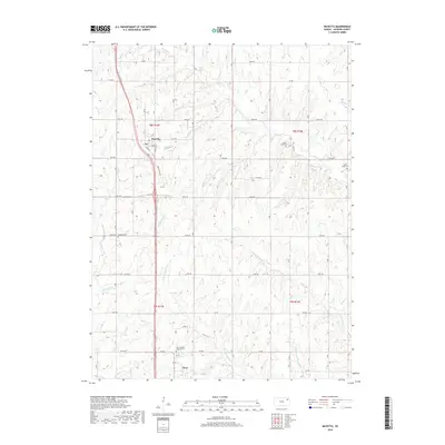
2018 Map of Mayetta
USGS Topo · Published 2018About this map
Mayetta and Hoyt anchor this Jackson County landscape, representing two distinct hubs of rural settlement connected by a modern road network. The terrain is deeply carved by the headwaters of the Muddy Creek system, including the W Fork Muddy Cr and E Fork Muddy Cr, which flow southward through agricultural sections. This 2018 survey illustrates the persistent importance of local history through its cemetery locations, such as Saint Joseph's Catholic Cem and Cedar Grove Cem, which often mark the centers of early community life in this part of Kansas.
Find a feature on this map
36 named features on this map. Tap any name to fly to it.
Don’t see what you’re looking for? This feature index may not catch every label — zoom into the map to look around manually.
Map Details
Editions of this 2018 Mayetta Map
This is the sole edition of this map. No revisions or reprints were ever made.
Other maps of this area

1889 · Topeka
USGS Topo · 1:125,000

1894 · Topeka
USGS Topo · 1:125,000

1950 · Kansas City
USGS Topo · 1:250,000

1952 · Elmont
USGS Topo · 1:24,000

1952 · Grove
USGS Topo · 1:24,000
1952 · Meriden
USGS Topo · 1:24,000

1954 · Kansas City
USGS Topo · 1:250,000

1956 · Kansas City
USGS Topo · 1:250,000

1960 · Kansas City
USGS Topo · 1:250,000
1960 · Mayetta
USGS Topo · 1:24,000