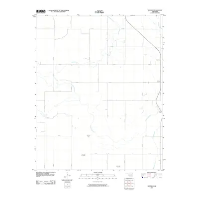
2010 Map of Mayfield
USGS Topo · Published 2010About this map
The Mayfield settlement anchors this western Oklahoma landscape, serving as a focal point in a region defined by agricultural grids and a complex network of prairie waterways. This 2010 survey illustrates the hydrological importance of the North Fork Red River, which winds through the southern portion of the quadrangle. A series of flood control structures, including the Cow Creek Site 4 Dam, Cow Creek Site 6 Dam, and Cow Creek Site 7 Dam, demonstrate modern efforts to manage the watershed that feeds into the larger river system. Local history is preserved at the Mayfield Cemetery and Tittle Bridge, which provide specific points of interest for genealogists and researchers mapping family land holdings. The map's grid is dominated by rural routes such as E 1160 RD and N 1720 RD, intersecting the paths of Sweetwater Creek and Little Turkey Creek as they traverse the Beckham County terrain.
Find a feature on this map
28 named features on this map. Tap any name to fly to it.
Don’t see what you’re looking for? This feature index may not catch every label — zoom into the map to look around manually.
Map Details
Editions of this 2010 Mayfield Map
This is the sole edition of this map. No revisions or reprints were ever made.
Other maps of this area

1954 · Amarillo
USGS Topo · 1:250,000

1955 · Clinton
USGS Topo · 1:250,000

1957 · Clinton
USGS Topo · 1:250,000

1958 · Amarillo
USGS Topo · 1:250,000

1960 · Sweetwater
USGS Topo · 1:62,500

1961 · Erick
USGS Topo · 1:62,500

1962 · Kelton SE
USGS Topo · 1:24,000

1963 · Kelton
USGS Topo · 1:24,000

1963 · Fulller
USGS Topo · 1:24,000
1983 · Shamrock
USGS Topo · 1:100,000