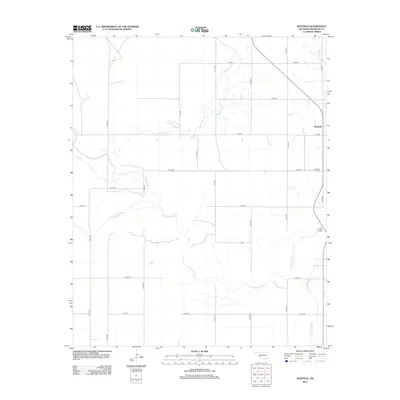
2012 Map of Mayfield
USGS Topo · Published 2012About this map
The Mayfield community in western Oklahoma sits at a crossroads of the southern plains where several vital waterways converge. The agricultural landscape is defined by the winding course of the N Fork Red River and its many tributaries, including Sweetwater Cr, Salt Cr, and Little Turkey Cr. These water sources historically dictated the layout of rural section lines and local transit, as seen in the grid of county roads that navigate the varying terrain.
Find a feature on this map
25 named features on this map. Tap any name to fly to it.
Don’t see what you’re looking for? This feature index may not catch every label — zoom into the map to look around manually.
Map Details
Editions of this 2012 Mayfield Map
This is the sole edition of this map. No revisions or reprints were ever made.
Other maps of this area

1954 · Amarillo
USGS Topo · 1:250,000

1955 · Clinton
USGS Topo · 1:250,000

1957 · Clinton
USGS Topo · 1:250,000

1958 · Amarillo
USGS Topo · 1:250,000

1960 · Sweetwater
USGS Topo · 1:62,500

1961 · Erick
USGS Topo · 1:62,500

1962 · Kelton SE
USGS Topo · 1:24,000

1963 · Kelton
USGS Topo · 1:24,000

1963 · Fulller
USGS Topo · 1:24,000
1983 · Shamrock
USGS Topo · 1:100,000