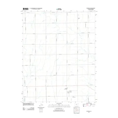
2012 Map of Mayfield
USGS Topo · Published 2012About this map
Mayfield serves as the primary hub in this Sumner County landscape, located along the southern edge of the survey where the Post Office and the Mayfield Wastewater Treatment Facility are situated. The surrounding terrain is defined by a systematic grid of section roads and a complex network of waterways, including the winding course of Slate Cr and the divergent branches of W Prairie Cr and E Prairie Cr. The northern reaches of the quadrangle are anchored by the settlement of Anson, which sits near the headwaters of the eastern creeks. Local history and genealogy researchers will find two significant burial sites documented: Austin Cem in the northeast and Osborne Township Cem located south of Mayfield along Long Cr. The map's detail illustrates a late-twentieth-century agricultural layout, where established township boundaries intersect with natural drainages like Beaver Cr.
Find a feature on this map
34 named features on this map. Tap any name to fly to it.
Don’t see what you’re looking for? This feature index may not catch every label — zoom into the map to look around manually.
Map Details
Editions of this 2012 Mayfield Map
This is the sole edition of this map. No revisions or reprints were ever made.
Other maps of this area

1889 · Caldwell
USGS Topo · 1:125,000

1890 · Wellington
USGS Topo · 1:125,000

1893 · Caldwell
USGS Topo · 1:125,000

1897 · Caldwell
USGS Topo · 1:125,000
1955 · Zyba
USGS Topo · 1:24,000

1955 · Wichita
USGS Topo · 1:250,000

1958 · Wichita
USGS Topo · 1:250,000

1965 · Rome
USGS Topo · 1:24,000
1965 · Wellington
USGS Topo · 1:24,000

1971 · Caldwell NW
USGS Topo · 1:24,000