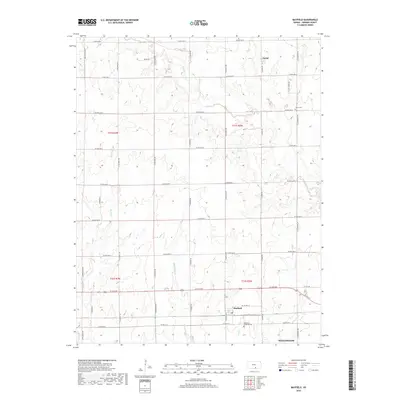
2018 Map of Mayfield
USGS Topo · Published 2018About this map
Mayfield and the northern outskirts of Wellington define this section of Sumner County, where the agricultural landscape is carved by a network of prairie waterways. The terrain is structured by the drainage patterns of Slate Creek, Beaver Creek, and both the West and East Prairie Creeks. This late-period survey illustrates a persistent rural grid system of section-line roads, such as N Sumner Road and W 80th Ave N, which connect scattered homesteads and local landmarks. Genealogists and local historians will find value in the precise locations of the Osborne Township Cemetery and Austin Cemetery, alongside the small settlement of Anson to the north. The presence of Meyer Lse suggests localized resource extraction or industrial activity within the township boundaries of t31s r2w and t32s r3w.
Find a feature on this map
42 named features on this map. Tap any name to fly to it.
Don’t see what you’re looking for? This feature index may not catch every label — zoom into the map to look around manually.
Map Details
Editions of this 2018 Mayfield Map
This is the sole edition of this map. No revisions or reprints were ever made.
Other maps of this area

1889 · Caldwell
USGS Topo · 1:125,000

1890 · Wellington
USGS Topo · 1:125,000

1893 · Caldwell
USGS Topo · 1:125,000

1897 · Caldwell
USGS Topo · 1:125,000
1955 · Zyba
USGS Topo · 1:24,000

1955 · Wichita
USGS Topo · 1:250,000

1958 · Wichita
USGS Topo · 1:250,000

1965 · Rome
USGS Topo · 1:24,000
1965 · Wellington
USGS Topo · 1:24,000

1971 · Caldwell NW
USGS Topo · 1:24,000