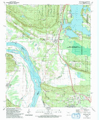
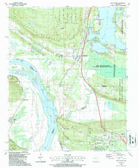
1987 Map of Mayflower
USGS Topo · Published 1992About this map
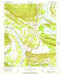
Mayflower serves as the focal point of this late 1980s landscape where the Union Pacific railroad tracks and the winding Palarm Creek define the local geography. The area is characterized by a mix of established community institutions like the Mayflower High Sch and Mayflower Cem, alongside large-scale conservation and military tracts. East of the town center, the Bell Slough State Wildlife Management Area and Camp Joseph T Robinson encompass significant portions of the terrain, bordering the expansive waters of Conway Lake and Grassy Lake. To the south and west, the Arkansas River forms a wide bend near Beaverdam Island, where the Murray Lake pool elevation is noted. This period shows a transition from rural crossroads like Mount Pilgrim and Roland toward more modern residential development near Maumelle and West Marche, reflecting the shifting patterns of the region's growth.
Find a feature on this map
56 named features on this map. Tap any name to fly to it.
Don’t see what you’re looking for? This feature index may not catch every label — zoom into the map to look around manually.
Map Details
Editions of this 1987 Mayflower Map
2 editions found
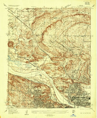
Other maps of this area

1890 · Benton
USGS Topo · 1:125,000

1891 · Little Rock
USGS Topo · 1:125,000

1892 · Morrillton
USGS Topo · 1:125,000

1893 · Little Rock
USGS Topo · 1:125,000

1894 · Morrillton
USGS Topo · 1:125,000

1894 · Benton
USGS Topo · 1:125,000
1935 · North Little Rock
USGS Topo · 1:24,000

1943 · Pinnacle Mtn
USGS Topo · 1:31,680
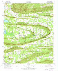
1953 · Cato
USGS Topo · 1:24,000
1953 · Mayflower
USGS Topo · 1:24,000