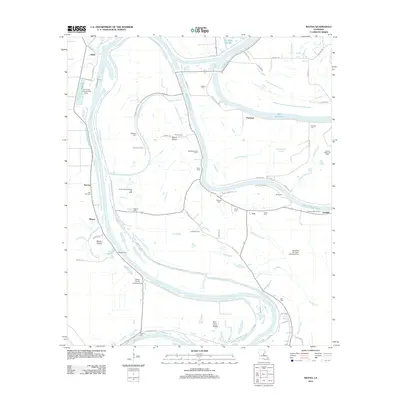
2012 Map of Mayna
USGS Topo · Published 2012About this map
Black River meanders through the heart of this alluvial landscape, defining the boundaries of communities like Mayna, Glade, and Eva. The terrain is characterized by a complex network of waterways, including Black River Lake, Cynthia Bayou, and Buttonwood Slough, which reflect the historic drainage patterns of the Mississippi Delta. In the early 2010s, this area remained largely defined by its rural character and the extraction of natural resources, as evidenced by the Scott Bayou Oil Field and the South Cynthia Bayou Oil Field.
Find a feature on this map
74 named features on this map. Tap any name to fly to it.
Don’t see what you’re looking for? This feature index may not catch every label — zoom into the map to look around manually.
Map Details
Editions of this 2012 Mayna Map
This is the sole edition of this map. No revisions or reprints were ever made.
Other maps of this area

1935 · Tooleys
USGS Topo · 1:62,500

1939 · Red Gum
USGS Topo · 1:62,500

1939 · Deer Park
USGS Topo · 1:62,500

1941 · Manifest
USGS Topo · 1:62,500

1941 · Tooleys
USGS Topo · 1:62,500

1953 · Natchez
USGS Topo · 1:250,000

1956 · Natchez
USGS Topo · 1:250,000

1959 · Natchez
USGS Topo · 1:250,000

1960 · Jonesville
USGS Topo · 1:62,500
1960 · Eva
USGS Topo · 1:62,500