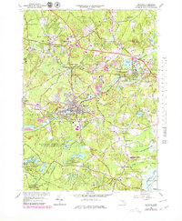
1965 Map of Maynard
USGS Topo · Published 1979About this map
The Assabet River winds through this industrial and residential landscape of eastern Massachusetts, anchoring the mill town of Maynard. This late 1970s revision, based on earlier topographic surveys, illustrates the region's mid-century expansion through its extensive network of schools and institutional landmarks. Notable features include the Concord Reformatory and the U S Military Reservation Natick Laboratories, which represent the significant state and federal presence in the area.
Find a feature on this map
85 named features on this map. Tap any name to fly to it.
Don’t see what you’re looking for? This feature index may not catch every label — zoom into the map to look around manually.
Map Details
Editions of this 1965 Maynard Map
3 editions found
Other maps of this area

1886 · Lowell
USGS Topo · 1:62,500

1886 · Framingham
USGS Topo · 1:62,500

1887 · Marlboro
USGS Topo · 1:62,500

1889 · Marlboro
USGS Topo · 1:62,500

1889 · Framingham
USGS Topo · 1:62,500

1893 · Lowell
USGS Topo · 1:62,500

1893 · Groton
USGS Topo · 1:62,500

1894 · Framingham
USGS Topo · 1:62,500

1896 · Marlboro
USGS Topo · 1:62,500

1898 · Marlboro
USGS Topo · 1:62,500