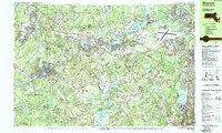
1987 Map of Maynard
USGS Topo · Published 1987About this map
The Assabet River and Concord River anchor this 1987 survey of the Middlesex County landscape, illustrating a region where Revolutionary War history meets late 20th-century institutional expansion. Large swaths of the terrain are dedicated to conservation and public memory, notably at Walden Pond State Res and the sprawling Minute Man Nat Hist Park. These preservation efforts sit alongside a heavy military and research presence, including Hanscom Air Force Base and the U S Military Reservation Natick Laboratories.
Find a feature on this map
119 named features on this map. Tap any name to fly to it.
Don’t see what you’re looking for? This feature index may not catch every label — zoom into the map to look around manually.
Map Details
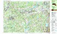
Editions of this 1987 Maynard Map
2 editions found
Other maps of this area

1886 · Lawrence
USGS Topo · 1:62,500

1886 · Lowell
USGS Topo · 1:62,500

1886 · Framingham
USGS Topo · 1:62,500

1887 · Marlboro
USGS Topo · 1:62,500

1888 · Lawrence
USGS Topo · 1:62,500

1889 · Marlboro
USGS Topo · 1:62,500

1889 · Framingham
USGS Topo · 1:62,500

1893 · Lowell
USGS Topo · 1:62,500

1893 · Boston
USGS Topo · 1:62,500

1893 · Lawrence
USGS Topo · 1:62,500