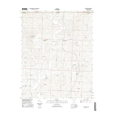
2017 Map of Maynard
USGS Topo · Published 2017About this map
The Fourche River winds through the heart of the northern Arkansas borderlands, anchoring a landscape of scattered rural communities and family cemeteries in Randolph Co. This 2017 survey shows the enduring layout of Maynard, where local life is centered near Maynard Cem and the surrounding drainage of Lemmons Cr. Further north, smaller settlements like Middlebrook and Brakebill dot the higher ground above Hagood Cr and Waldron Cr.
Find a feature on this map
82 named features on this map. Tap any name to fly to it.
Don’t see what you’re looking for? This feature index may not catch every label — zoom into the map to look around manually.
Map Details
Editions of this 2017 Maynard Map
This is the sole edition of this map. No revisions or reprints were ever made.
Other maps of this area

1935 · Reyno
USGS Topo · 1:62,500

1939 · Doniphan
USGS Topo · 1:62,500

1941 · Gatewood
USGS Topo · 1:62,500

1945 · Doniphan
USGS Topo · 1:62,500

1945 · Gatewood
USGS Topo · 1:62,500

1957 · Poplar Bluff
USGS Topo · 1:250,000

1959 · Poplar Bluff
USGS Topo · 1:250,000

1960 · Poplar Bluff
USGS Topo · 1:250,000

1965 · Gatewood
USGS Topo · 1:24,000
1966 · Ravenden Springs SE
USGS Topo · 1:24,000