
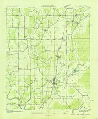
1936 Map of Maysville
USGS Topo · Published 1936About this map
The Flint River defines the central axis of this 1936 Madison County survey, where early river-based industry and agrarian settlements characterize the landscape. Industrial heritage is evident at Bell Factory and McCaleb Mill, while the Nashville Chattanooga and St Louis Railway and the Southern Railway provide the era's primary transportation backbone. The map captures a high density of rural community markers, including Shiloh Ch, Jordan Cem, and Wear Chapel near the settlement of Ryland.
Find a feature on this map
72 named features on this map. Tap any name to fly to it.
Don’t see what you’re looking for? This feature index may not catch every label — zoom into the map to look around manually.
Map Details
Editions of this 1936 Maysville Map
This is the sole edition of this map. No revisions or reprints were ever made.
Other maps of this area

1888 · Scottsboro
USGS Topo · 1:125,000

1888 · Huntsville
USGS Topo · 1:125,000

1892 · Huntsville
USGS Topo · 1:125,000

1892 · Scottsboro
USGS Topo · 1:125,000

1936 · King Cove
USGS Topo · 1:24,000

1936 · Meridianville
USGS Topo · 1:24,000

1936 · Moontown
USGS Topo · 1:24,000

1936 · Fisk
USGS Topo · 1:24,000

1936 · Hollytree
USGS Topo · 1:24,000
1936 · New Market
USGS Topo · 1:24,000