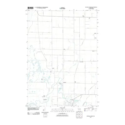
2010 Map of Mayville North
USGS Topo · Published 2010About this map
The East Branch Rock River anchors this agricultural landscape north of Mayville, driving the historical development of settlements like Kekoskee and LeRoy. The river's path is marked by several water control features, including the Kekoskee Dam and the Furnace Bridge Dam, which created the Kekoskee Millpond 182 and Lower Mayville Millpond 174. These millponds suggest a legacy of local industry tied to the water's flow before it enters the northern reaches of the marsh.
Find a feature on this map
57 named features on this map. Tap any name to fly to it.
Don’t see what you’re looking for? This feature index may not catch every label — zoom into the map to look around manually.
Map Details
Editions of this 2010 Mayville North Map
This is the sole edition of this map. No revisions or reprints were ever made.
Other maps of this area

1904 · Hartford
USGS Topo · 1:62,500

1955 · Waupun
USGS Topo · 1:62,500

1955 · Campbellsport
USGS Topo · 1:62,500

1955 · Horicon
USGS Topo · 1:62,500

1957 · Madison
USGS Topo · 1:250,000

1959 · Hartford
USGS Topo · 1:62,500

1959 · Nenno
USGS Topo · 1:24,000

1960 · Madison
USGS Topo · 1:250,000
1974 · Byron
USGS Topo · 1:24,000
1974 · Lomira
USGS Topo · 1:24,000