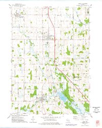
1974 Map of Lomira
USGS Topo · Published 1978About this map
Theresa Marsh State Wildlife Area dominates the southern landscape of this 1974 survey, where the Rock River and its branches weave through a glacial terrain defined by drumlins. The villages of Lomira and Theresa serve as the primary hubs of the region, situated along a north-south corridor that includes the C M St P & P railroad and ancient waterways. Local family and religious history is deeply embedded in the land, evidenced by numerous burial grounds such as Wayne Cem, Union Cem, and St Marys Cem.
Find a feature on this map
61 named features on this map. Tap any name to fly to it.
Don’t see what you’re looking for? This feature index may not catch every label — zoom into the map to look around manually.
Map Details
Editions of this 1974 Lomira Map
This is the sole edition of this map. No revisions or reprints were ever made.
Other maps of this area

1904 · Hartford
USGS Topo · 1:62,500

1955 · Waupun
USGS Topo · 1:62,500

1955 · Campbellsport
USGS Topo · 1:62,500

1955 · Horicon
USGS Topo · 1:62,500

1957 · Madison
USGS Topo · 1:250,000

1959 · Hartford
USGS Topo · 1:62,500

1959 · Nenno
USGS Topo · 1:24,000

1959 · Allenton
USGS Topo · 1:24,000

1960 · Madison
USGS Topo · 1:250,000
1974 · Campbellsport
USGS Topo · 1:24,000