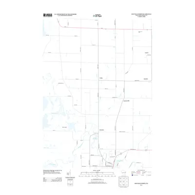
2013 Map of Mayville North
USGS Topo · Published 2013About this map
The E Br Rock River anchors this Dodge County landscape, its course through the southern terrain punctuated by the Kekoskee Millpond 182 and the Lower Mayville Millpond 174. The settlement of Kekoskee sits at the water's edge, serving as a focal point for the surrounding agricultural community. To the north, the small hamlets of LeRoy and Farmersville are connected by a grid of rural roads and county highways, including County Hwy-YY and County Hwy-V.
Find a feature on this map
57 named features on this map. Tap any name to fly to it.
Don’t see what you’re looking for? This feature index may not catch every label — zoom into the map to look around manually.
Map Details
Editions of this 2013 Mayville North Map
This is the sole edition of this map. No revisions or reprints were ever made.
Other maps of this area

1904 · Hartford
USGS Topo · 1:62,500

1955 · Waupun
USGS Topo · 1:62,500

1955 · Campbellsport
USGS Topo · 1:62,500

1955 · Horicon
USGS Topo · 1:62,500

1957 · Madison
USGS Topo · 1:250,000

1959 · Hartford
USGS Topo · 1:62,500

1959 · Nenno
USGS Topo · 1:24,000

1960 · Madison
USGS Topo · 1:250,000
1974 · Byron
USGS Topo · 1:24,000
1974 · Lomira
USGS Topo · 1:24,000