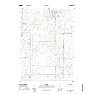
2018 Map of Mayville South
USGS Topo · Published 2018About this map
The East Branch Rock River winds through the heart of Mayville, a community marked by its deep religious and civic heritage as seen through its concentration of burial grounds. From Old Saint Marys Cem and Saint Johns Cem near the town center to the outlying Saint Paul Cem, these landmarks provide essential data for local genealogy. To the west, the expansive wetlands of Horicon Marsh contain a series of named landforms such as Rudebush Island and Koch Island, while the southern reaches of the map transition into the waters of Sinissippi Lake at Radloff Point. Smaller hamlets like Neda and Iron Ridge are connected by a network of rural roads that cross several tributaries, including Wildcat Cr and Lentz Cr. The landscape is a mix of structured village life and significant marshland conservation areas, anchored by the industrial and residential history of the Rock River valley.
Find a feature on this map
96 named features on this map. Tap any name to fly to it.
Don’t see what you’re looking for? This feature index may not catch every label — zoom into the map to look around manually.
Map Details
Editions of this 2018 Mayville South Map
This is the sole edition of this map. No revisions or reprints were ever made.
Other maps of this area

1904 · Hartford
USGS Topo · 1:62,500

1955 · Waupun
USGS Topo · 1:62,500

1955 · Campbellsport
USGS Topo · 1:62,500

1955 · Horicon
USGS Topo · 1:62,500

1957 · Madison
USGS Topo · 1:250,000

1959 · Hartford
USGS Topo · 1:62,500

1959 · Nenno
USGS Topo · 1:24,000
1959 · Hartford West
USGS Topo · 1:24,000

1960 · Madison
USGS Topo · 1:250,000
1974 · Lomira
USGS Topo · 1:24,000