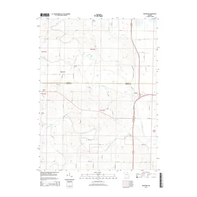
2015 Map of Maywood
USGS Topo · Published 2015About this map
The North Fabius River and South Fabius River define the winding drainage of this northeastern Missouri landscape, which straddles the Lewis and Marion County line. Near the northern border of the sheet, the village of Maywood serves as a local hub, situated just west of its namesake Maywood Cemetery. The map captures a detailed view of the rural township structure, showing the transition from the Middle Fabius River in the northwest to the settlement of Taylor in the east. Genealogists and local historians will find several burial sites preserved here, including Liberty Cemetery, Hebron Cemetery, and Sunrise Cemetery. Man-made water features like Maple Lake and C-B Keller Lake are prominent among the numerous county roads and creek branches, such as Bethel Br and Durgens Cr, that weave through the river bottomlands.
Find a feature on this map
49 named features on this map. Tap any name to fly to it.
Don’t see what you’re looking for? This feature index may not catch every label — zoom into the map to look around manually.
Map Details
Editions of this 2015 Maywood Map
This is the sole edition of this map. No revisions or reprints were ever made.
Other maps of this area

1903 · Kahoka
USGS Topo · 1:125,000

1903 · Palmyra
USGS Topo · 1:125,000

1925 · Quincy
USGS Topo · 1:62,500

1944 · Quincy
USGS Topo · 1:62,500

1945 · Quincy
USGS Topo · 1:62,500

1946 · Mendon
USGS Topo · 1:62,500

1948 · Quincy
USGS Topo · 1:250,000

1948 · Mendon
USGS Topo · 1:62,500

1949 · Durham
USGS Topo · 1:24,000

1949 · Maywood
USGS Topo · 1:24,000