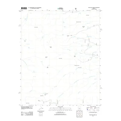
2011 Map of Mazatzal Peak
USGS Topo · Published 2011About this map
Mazatzal Peak dominates this high-altitude landscape in central Arizona, where steep ridgelines and deep canyons define the drainage patterns of the region. The map reveals a network of seasonal water sources and livestock management points essential for mountain use, including Barnhardt Tank, Suicide Tank, and Y Bar Tanks. Human activity is primarily centered around seasonal camps and backcountry access, with locations like Chilson Camp, Gowan Camp, and Windsor Camp providing historic points of reference for researchers and hikers. The presence of established access points such as the Barnhardt Trailhead and Peeley Trailhead underscores the area's role as a gateway to the high mesas. Terrain features like Fisher Mesa and Barnhardt Mesa are cut by complex washes such as Boone Moore Wash and Clover Wash, showing the intricate erosion patterns of the Mazatzal Range.
Find a feature on this map
56 named features on this map. Tap any name to fly to it.
Don’t see what you’re looking for? This feature index may not catch every label — zoom into the map to look around manually.
Map Details
Editions of this 2011 Mazatzal Peak Map
This is the sole edition of this map. No revisions or reprints were ever made.
Other maps of this area

1887 · Verde
USGS Topo · 1:250,000

1892 · Verde
USGS Topo · 1:250,000

1907 · Roosevelt
USGS Topo · 1:125,000

1909 · Four Peaks
USGS Topo · 1:125,000

1912 · Roosevelt
USGS Topo · 1:125,000

1929 · Turret Peak
USGS Topo · 1:125,000

1930 · Cave Creek
USGS Topo · 1:125,000

1933 · Turret Peak
USGS Topo · 1:125,000

1936 · Payson
USGS Topo · 1:48,000

1939 · Cave Creek
USGS Topo · 1:125,000