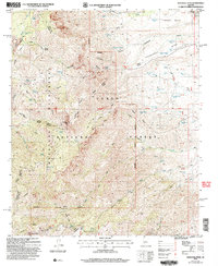
2004 Map of Mazatzal Peak
USGS Topo · Published 2007About this map
Mazatzal Peak dominates the high-elevation terrain of the Mazatzal Mountains, a landscape defined by sharp ridges and deep drainage systems. This 2004 revision of earlier 1965 topography shows the remote character of the Mazatzal Wilderness within the Tonto National Forest, where water management is critical to the local geography. The map documents numerous hydrologic features, from Horse Camp Seep and Boone Moore Spring to cattle-related improvements like Suicide Tank No 2 and Table Top Tank. A complex network of historic routes, including the Mazatzal Divide Trail and Davenport Trail, provides access to high-country points like Sandy Saddle and Mount Peeley. Remnants of human presence are noted at Chilson Camp and Gowan Camp, which mark the sparse settlement pattern of this Yavapai and Gila county borderland.
Find a feature on this map
79 named features on this map. Tap any name to fly to it.
Don’t see what you’re looking for? This feature index may not catch every label — zoom into the map to look around manually.
Map Details
Editions of this 2004 Mazatzal Peak Map
This is the sole edition of this map. No revisions or reprints were ever made.
Other maps of this area

1887 · Verde
USGS Topo · 1:250,000

1892 · Verde
USGS Topo · 1:250,000

1907 · Roosevelt
USGS Topo · 1:125,000

1909 · Four Peaks
USGS Topo · 1:125,000

1912 · Roosevelt
USGS Topo · 1:125,000

1929 · Turret Peak
USGS Topo · 1:125,000

1930 · Cave Creek
USGS Topo · 1:125,000

1933 · Turret Peak
USGS Topo · 1:125,000

1936 · Payson
USGS Topo · 1:48,000

1939 · Cave Creek
USGS Topo · 1:125,000