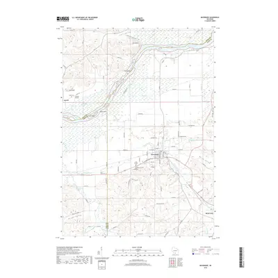
2018 Map of Mazomanie
USGS Topo · Published 2018About this map
Mazomanie and Black Earth occupy the lowlands of the Black Earth Cr valley, where the landscape transitions from the southern uplands toward the broad corridor of the Wisconsin River. This survey captures the rural character of the region, emphasizing the complex drainage system of Halfway Prairie Cr and Dunlap Cr as they feed into the river's northern floodplains. To the northwest, the river's path is marked by distinctive features such as Ferry Bluff and the Twin Islands, which sit across from the agricultural flats of Cassell Prairie. Genealogists and local historians can locate several burial grounds preserved in the landscape, including Saint Barnabas Cem, Mazomanie Cem, and the Dover Culver Cem. The map illustrates the 21st-century road network and the enduring topographical boundaries that define Knight Valley and Fair Valley within this corner of Dane County.
Find a feature on this map
83 named features on this map. Tap any name to fly to it.
Don’t see what you’re looking for? This feature index may not catch every label — zoom into the map to look around manually.
Map Details
Editions of this 2018 Mazomanie Map
This is the sole edition of this map. No revisions or reprints were ever made.
Other maps of this area

1895 · Baraboo
USGS Topo · 1:62,500

1901 · Denzer
USGS Topo · 1:62,500

1907 · Cross Plains
USGS Topo · 1:62,500

1908 · Baraboo
USGS Topo · 1:62,500

1909 · Cross Plains
USGS Topo · 1:62,500

1920 · Blue Mounds
USGS Topo · 1:62,500

1922 · Blue Mounds
USGS Topo · 1:62,500

1957 · Madison
USGS Topo · 1:250,000

1958 · North Freedom
USGS Topo · 1:62,500

1959 · Baraboo
USGS Topo · 1:62,500