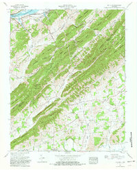
1961 Map of Mc Cloud
USGS Topo · Published 1981About this map
McCloud and the surrounding ridgelines of the Bays Mountain range dominate this landscape along the boundary of Hawkins and Greene Counties. The John Sevier Steam Plant sits prominently near the Holston River and Cherokee Lake, signaling the mid-century industrialization of the Tennessee Valley. Despite this modernization, the area retains a dense network of family settlements and rural institutions. Small communities like Kite, Needmore, and Romeo are anchored by landmarks such as the Romeo Sch and Dodson Creek Ch. Genealogists will find a wealth of burial sites tucked into the hollows, including the Reynolds Cem, Providence Cem, and Louderback Cem. The terrain is characterized by steep summits like Grassy Mountain and Brushy Mountain, where narrow gaps such as Lawson Gap provided critical passage through the difficult upland topography.
Find a feature on this map
78 named features on this map. Tap any name to fly to it.
Don’t see what you’re looking for? This feature index may not catch every label — zoom into the map to look around manually.
Map Details
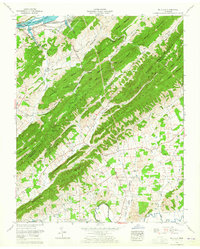
Editions of this 1961 Mc Cloud Map
2 editions found
Other maps of this area

1883 · Morristown
USGS Topo · 1:125,000

1892 · Greeneville
USGS Topo · 1:125,000

1893 · Morristown
USGS Topo · 1:125,000

1895 · Morristown
USGS Topo · 1:125,000

1896 · Greeneville
USGS Topo · 1:125,000

1904 · Greeneville
USGS Topo · 1:125,000

1935 · Surgoinsville
USGS Topo · 1:48,000

1935 · Baileyton
USGS Topo · 1:24,000

1935 · Rogersville
USGS Topo · 1:48,000

1935 · McCloud
USGS Topo · 1:24,000