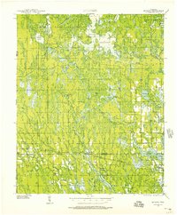
1939 Map of Mc Cord
USGS Topo · Published 1957About this map
Willow Reservoir dominates the northern landscape of this Oneida County terrain, where a complex network of wetlands and small lakes defines the region's hydrography. In the late 1930s, the area remained deeply rural, characterized by scattered schoolhouses like Harmony Sch, Kelly Sch, and Lund Sch that served isolated farming and timber families. The transit infrastructure of the era is anchored by the Sault Ste Marie and No 8 Highway and two primary rail lines: the St Paul and Sault Ste Marie RR and the Marinette Tomahawk and Western RR. Small railway settlements such as McCord and Tripoli mark the intersections of transportation and industry, while the presence of a CCC Camp and the Jack Pine Fire Tower reflects the period's active forest management and conservation efforts in the Northwoods.
Find a feature on this map
61 named features on this map. Tap any name to fly to it.
Don’t see what you’re looking for? This feature index may not catch every label — zoom into the map to look around manually.
Map Details
Editions of this 1939 Mc Cord Map
3 editions found
Other maps of this area

1938 · Minocqua
USGS Topo · 1:48,000

1938 · Lac Du Flambeau
USGS Topo · 1:48,000

1939 · Lac Du Flambeau
USGS Topo · 1:48,000

1939 · Mc Cord
USGS Topo · 1:48,000

1939 · Cassian
USGS Topo · 1:48,000

1941 · Pike Lake
USGS Topo · 1:48,000

1941 · Brantwood
USGS Topo · 1:48,000

1942 · Pike Lake
USGS Topo · 1:48,000

1942 · Cassian
USGS Topo · 1:48,000

1943 · Brantwood
USGS Topo · 1:48,000