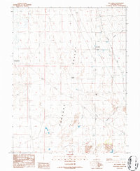
1986 Map of Mc Cornick
USGS Topo · Published 1987About this map
Pahvant Valley defines the landscape of this Millard County survey, where agricultural development meets the alkaline Mud Flats of the Great Basin. The small settlement of Mc Cornick serves as the focal point for local irrigation and infrastructure, situated near the Delta Substa 2. Water management is central to the area's survival, evidenced by the prominent Central Utah Canal which cuts across the northeastern terrain to redirect vital flow.
Find a feature on this map
20 named features on this map. Tap any name to fly to it.
Don’t see what you’re looking for? This feature index may not catch every label — zoom into the map to look around manually.
Map Details
Editions of this 1986 Mc Cornick Map
This is the sole edition of this map. No revisions or reprints were ever made.
Other maps of this area

1885 · Sevier Desert
USGS Topo · 1:250,000

1951 · Oak City
USGS Topo · 1:62,500

1953 · Delta
USGS Topo · 1:250,000

1958 · Delta
USGS Topo · 1:250,000

1962 · Delta
USGS Topo · 1:250,000
1962 · The Sink
USGS Topo · 1:24,000
1962 · Holden
USGS Topo · 1:24,000

1962 · Holden
USGS Topo · 1:62,500

1962 · Delta
USGS Topo · 1:62,500

1971 · Pavant Butte North
USGS Topo · 1:24,000