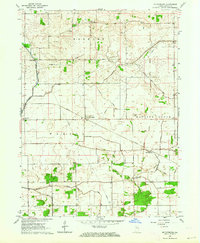
1962 Map of Mc Coysburg
USGS Topo · Published 1964About this map
The Iroquois River winds through the northwest corner of this Jasper County landscape, anchoring a region defined by an extensive drainage network that includes the Ryan Ditch and Monon Ditch. This early 1960s survey captures the rural character of northern Indiana, where small settlements like Barkley, Pleasant Ridge, and McCoysburg are connected by the tracks of the Monon Railroad. The map reveals a high density of small family and community burial grounds, such as Smith Cem, Henkle Cem, and Parkison Cem, which serve as vital markers for local genealogical research.
Find a feature on this map
31 named features on this map. Tap any name to fly to it.
Don’t see what you’re looking for? This feature index may not catch every label — zoom into the map to look around manually.
Map Details
Editions of this 1962 Mc Coysburg Map
This is the sole edition of this map. No revisions or reprints were ever made.
Other maps of this area

1953 · Chicago
USGS Topo · 1:250,000

1953 · Danville
USGS Topo · 1:250,000

1955 · Danville
USGS Topo · 1:250,000

1956 · Danville
USGS Topo · 1:250,000

1957 · Chicago
USGS Topo · 1:250,000

1962 · Monon
USGS Topo · 1:24,000

1962 · Medaryville
USGS Topo · 1:24,000

1962 · Gifford
USGS Topo · 1:24,000

1962 · Parr
USGS Topo · 1:24,000
1962 · Francesville
USGS Topo · 1:24,000