
1962 Map of Monon
USGS Topo · Published 1964About this map
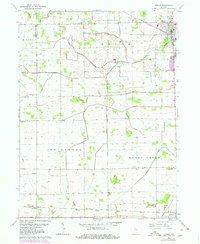
Monon serves as a central hub in northern White County during the early 1960s, defined by the intersection of rail lines and a complex network of agricultural drainage. The landscape is heavily modified for farming, evidenced by an intricate system of waterways including Walker Ditch, Mc Killip Ditch, and Hoagland Ditch. These man-made channels support the flat prairie land surrounding the settlements of Seafield and Reynolds. Local history and genealogy are anchored by several established burial grounds, such as Monon Cem, Palestine Cem, and Swisher Cem. The Pennsylvania railroad line and the Monon tracks illustrate the region's historical reliance on rail transport for moving goods and people through the Indiana countryside. Smaller landmarks like Storage Bins and a Sewage Disposal facility reflect the mid-century infrastructure of these rural communities.
Find a feature on this map
30 named features on this map. Tap any name to fly to it.
Don’t see what you’re looking for? This feature index may not catch every label — zoom into the map to look around manually.
Map Details
Editions of this 1962 Monon Map
2 editions found
Other maps of this area

1953 · Danville
USGS Topo · 1:250,000

1955 · Danville
USGS Topo · 1:250,000

1956 · Danville
USGS Topo · 1:250,000

1962 · Monticello South
USGS Topo · 1:24,000

1962 · Templeton NE
USGS Topo · 1:24,000

1962 · Monon NE
USGS Topo · 1:24,000

1962 · Brookston NW
USGS Topo · 1:24,000

1962 · Monticello North
USGS Topo · 1:24,000
1962 · Francesville
USGS Topo · 1:24,000
1962 · Mc Coysburg
USGS Topo · 1:24,000