
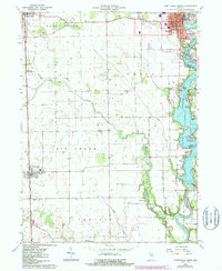
1962 Map of Monticello South
USGS Topo · Published 1963About this map
Lake Freeman dominates the eastern half of this landscape, created by the Oakdale Dam along the Tippecanoe River. This mid-century survey captures the recreational development along the shoreline, including Gingrich Addition, Lakewood, and numerous resorts like Sandy Beach and C & C Beach. The municipal center of Monticello is detailed with civic markers such as the Courthouse, City Hall, and Roosevelt High Sch, alongside its industrial rail connections.
Find a feature on this map
51 named features on this map. Tap any name to fly to it.
Don’t see what you’re looking for? This feature index may not catch every label — zoom into the map to look around manually.
Map Details
Editions of this 1962 Monticello South Map
2 editions found
Other maps of this area

1953 · Danville
USGS Topo · 1:250,000

1955 · Danville
USGS Topo · 1:250,000

1956 · Danville
USGS Topo · 1:250,000

1962 · Brookston SW
USGS Topo · 1:24,000

1962 · Brookston NW
USGS Topo · 1:24,000

1962 · Monon
USGS Topo · 1:24,000

1962 · Delphi
USGS Topo · 1:24,000

1962 · Monticello North
USGS Topo · 1:24,000
1962 · Yeoman
USGS Topo · 1:24,000
1962 · Idaville
USGS Topo · 1:24,000