
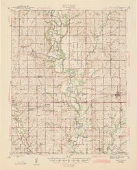
1945 Map of Mc Cune
USGS Topo · Published 1945About this map
The Neosho River meanders through the heart of this mid-1940s landscape, its complex oxbows and cutoffs creating a series of water bodies including Halfmoon Lake and Black Lake. This period is defined by the significant industrial presence of the Parsons Ordnance Plant in the southwest, reflecting the era's wartime mobilization. The rural social fabric is exceptionally well-documented through a dense network of one-room schoolhouses such as Pea Ridge Sch, Island Sch, and Neosho Valley Sch.
Find a feature on this map
69 named features on this map. Tap any name to fly to it.
Don’t see what you’re looking for? This feature index may not catch every label — zoom into the map to look around manually.
Map Details
Editions of this 1945 Mc Cune Map
2 editions found
Other maps of this area

1884 · Fort Scott
USGS Topo · 1:125,000

1886 · Joplin
USGS Topo · 1:125,000

1886 · Iola
USGS Topo · 1:125,000

1886 · Fort Scott
USGS Topo · 1:125,000

1886 · Parsons
USGS Topo · 1:125,000

1893 · Fort Scott
USGS Topo · 1:125,000

1893 · Iola
USGS Topo · 1:125,000

1893 · Parsons
USGS Topo · 1:125,000

1894 · Joplin
USGS Topo · 1:125,000

1904 · Iola
USGS Topo · 1:125,000