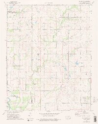
1973 Map of Mc Cune NE
USGS Topo · Published 1975About this map
Neosho State Waterfowl Management Area dominates the northern landscape of this region where Crawford, Neosho, and Labette counties meet. The survey reveals an economy rooted in both the land and the subsurface, with numerous Oil Field operations, a Gravel Pit, and scattered Gas Well sites distributed across the townships of Mission, Grant, Lincoln, and Osage. For genealogists, the map is particularly helpful for locating rural burial sites such as Valley City Cem, Frog Cem, and Dumbuld Cem, which are tucked away near the winding paths of Hickory Creek and Murphy Creek. The southern reach is defined by the Neosho River, featuring the distinctive oxbows of Halfmoon Lake and Little Halfmoon Lake, providing a clear look at the hydraulic patterns and land use of the early 1970s.
Find a feature on this map
24 named features on this map. Tap any name to fly to it.
Don’t see what you’re looking for? This feature index may not catch every label — zoom into the map to look around manually.
Map Details
Editions of this 1973 Mc Cune NE Map
2 editions found
Other maps of this area

1884 · Fort Scott
USGS Topo · 1:125,000

1886 · Joplin
USGS Topo · 1:125,000

1886 · Iola
USGS Topo · 1:125,000

1886 · Fort Scott
USGS Topo · 1:125,000

1886 · Parsons
USGS Topo · 1:125,000

1893 · Fort Scott
USGS Topo · 1:125,000

1893 · Iola
USGS Topo · 1:125,000

1893 · Parsons
USGS Topo · 1:125,000

1894 · Joplin
USGS Topo · 1:125,000

1904 · Iola
USGS Topo · 1:125,000