1967 Map of Mc Donald
USGS Topo · Published 1970About this map
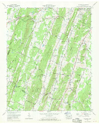
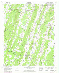
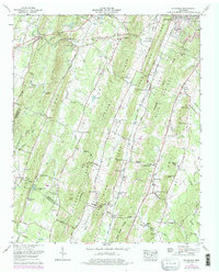
McDonald stands as a central community along the Southern Railway in this 1960s Bradley County landscape. The terrain is defined by a series of parallel ridges and valleys, including the prominent Lebanon ridge and the Blue Springs area. The settlement pattern follows the fertile valleys, with numerous family-named landmarks and water sources like Hysinger Spring and Jerry Johnson Spring indicating the importance of local hydrology to the rural economy.
Find a feature on this map
104 named features on this map. Tap any name to fly to it.
Don’t see what you’re looking for? This feature index may not catch every label — zoom into the map to look around manually.
Map Details
Editions of this 1967 Mc Donald Map
3 editions found
Other maps of this area

1886 · Dalton
USGS Topo · 1:125,000

1886 · Cleveland
USGS Topo · 1:125,000

1886 · Ringgold
USGS Topo · 1:125,000

1888 · Chattanooga
USGS Topo · 1:125,000

1892 · Ringgold
USGS Topo · 1:125,000

1892 · Cleveland
USGS Topo · 1:125,000

1892 · Dalton
USGS Topo · 1:125,000

1893 · Chattanooga
USGS Topo · 1:125,000

1895 · Cleveland
USGS Topo · 1:125,000

1897 · Dalton
USGS Topo · 1:125,000