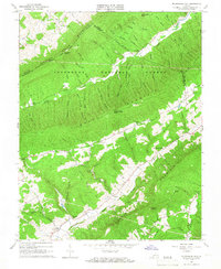
1965 Map of Mc Donalds Mill
USGS Topo · Published 1966About this map
The ridge-and-valley landscape of the Jefferson National Forest dominates this 1960s study, where the Craig and Montgomery County line follows the spine of Sinking Creek Mountain. Small agricultural pockets and family settlements are tucked into the drainages of Sinking Creek and the Roanoke River, with the Appalachian Trail traversing the northern heights.
Find a feature on this map
72 named features on this map. Tap any name to fly to it.
Don’t see what you’re looking for? This feature index may not catch every label — zoom into the map to look around manually.
Map Details
Editions of this 1965 Mc Donalds Mill Map
2 editions found
Other maps of this area

1890 · Christiansburg
USGS Topo · 1:125,000

1923 · Waiteville
USGS Topo · 1:62,500

1929 · Salem
USGS Topo · 1:48,000

1931 · Waiteville
USGS Topo · 1:48,000

1932 · Salem
USGS Topo · 1:62,500

1932 · Blacksburg
USGS Topo · 1:48,000

1937 · Blacksburg
USGS Topo · 1:62,500

1944 · Waiteville
USGS Topo · 1:62,500

1950 · Elliston
USGS Topo · 1:62,500

1951 · Waiteville
USGS Topo · 1:62,500