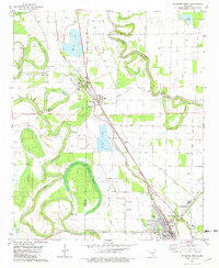
1981 Map of Mc Gehee North
USGS Topo · Published 1982About this map
Bayou Bartholomew and Bayou Macon wind through the Delta landscape of the early 1980s, framing the border between Drew and Desha counties. The town of McGehee serves as a major hub at the map's southern edge, where the Missouri Pacific railroad lines converge near Stephens Park and Wiley A. McGehee Park. This era shows a specialized agricultural shift, with large fish farms appearing near Tillar and north of Reed.
Find a feature on this map
43 named features on this map. Tap any name to fly to it.
Don’t see what you’re looking for? This feature index may not catch every label — zoom into the map to look around manually.
Map Details
Editions of this 1981 Mc Gehee North Map
This is the sole edition of this map. No revisions or reprints were ever made.
Other maps of this area

1935 · Cominto
USGS Topo · 1:62,500

1935 · Rotan
USGS Topo · 1:62,500

1935 · Red Fork
USGS Topo · 1:62,500

1936 · McGehee
USGS Topo · 1:62,500

1937 · McGehee
USGS Topo · 1:62,500

1953 · Greenwood
USGS Topo · 1:250,000

1955 · McGehee
USGS Topo · 1:62,500

1956 · Greenwood
USGS Topo · 1:250,000

1960 · Selma
USGS Topo · 1:24,000

1960 · Collins
USGS Topo · 1:24,000