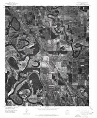
1975 Map of Mc Gehee NW
USGS Topo · Published 1976About this map
Bayou Bartholomew snakes in dramatic, tight oxbow loops across this Delta landscape, creating a distinctive hydrological pattern that defines the local geography. This 1975 orthophotograph, produced by the U.S. Geological Survey in cooperation with the Arkansas Geological Commission, reveals the intensive agricultural development of Desha County. Large, rectangular fields press against the winding banks of the bayou, showing how the land has been optimized for farming while following the natural contours of the ancient watercourse. The settlement of Tillar sits at a crossroads in the northern section, while the northern edge of Mc Gehee begins to appear in the southeast. For researchers, this aerial perspective provides an unfiltered look at the transportation corridors and field boundaries as they existed in the mid-1970s, before modern expansion altered the rural layout.
Find a feature on this map
3 named features on this map. Tap any name to fly to it.
Don’t see what you’re looking for? This feature index may not catch every label — zoom into the map to look around manually.
Map Details
Editions of this 1975 Mc Gehee NW Map
This is the sole edition of this map. No revisions or reprints were ever made.
Other maps of this area

1935 · Cominto
USGS Topo · 1:62,500

1935 · Rotan
USGS Topo · 1:62,500

1935 · Red Fork
USGS Topo · 1:62,500

1936 · McGehee
USGS Topo · 1:62,500

1937 · McGehee
USGS Topo · 1:62,500

1953 · Greenwood
USGS Topo · 1:250,000

1955 · McGehee
USGS Topo · 1:62,500

1956 · Greenwood
USGS Topo · 1:250,000

1960 · Selma
USGS Topo · 1:24,000

1960 · Collins
USGS Topo · 1:24,000