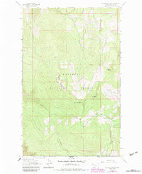
1963 Map of Mc Guire Mountain
USGS Topo · Published 1984About this map
Kootenai National Forest dominates this topographic study, where the high peaks of the northwestern Montana landscape are meticulously detailed. The terrain is anchored by McGuire Mountain and the dual peaks of Sutton Mountain and Little Sutton Mountain. This area is defined by its drainage network, with numerous waterways such as Sutton Creek, Briery Creek, and Tenmile Creek carving through the steep elevations.
Find a feature on this map
18 named features on this map. Tap any name to fly to it.
Don’t see what you’re looking for? This feature index may not catch every label — zoom into the map to look around manually.
Map Details
Editions of this 1963 Mc Guire Mountain Map
2 editions found
Other maps of this area

1957 · Kalispell
USGS Topo · 1:250,000

1960 · Kalispell
USGS Topo · 1:250,000

1961 · Kalispell
USGS Topo · 1:250,000

1963 · Mc Guire Mountain
USGS Topo · 1:24,000

1963 · Eureka South
USGS Topo · 1:24,000

1963 · Davis Mountain
USGS Topo · 1:24,000

1963 · Webb Mountain
USGS Topo · 1:24,000
1963 · Volcour
USGS Topo · 1:24,000
1963 · Pinkham Mountain
USGS Topo · 1:24,000
1963 · Inch Mountain
USGS Topo · 1:24,000