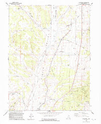
1992 Map of Mc Intyre
USGS Topo · Published 1992About this map
McIntyre and Jericho anchor this Juab County landscape, showing the transition of a high-desert terrain marked by early infrastructure and resource extraction. The presence of an Old Railroad Grade running through the central valley speaks to the region's transport history, while a modern Aqueduct cuts across the southern hills. Mineral interest is evident through scattered Prospects, Quarries, and a Mine Shaft located near the eastern boundary. Notable water sources such as Mud Springs, Riley Springs, and Diamond Creek define the survival patterns of the area, providing critical points in a landscape also defined by Chambers Wash and the Tintic Wash. The map also captures several human imprints on the land, from the No Name Well (Aban'd) to the Mc Intyre Road and Dennis Road corridors.
Find a feature on this map
33 named features on this map. Tap any name to fly to it.
Don’t see what you’re looking for? This feature index may not catch every label — zoom into the map to look around manually.
Map Details
Editions of this 1992 Mc Intyre Map
This is the sole edition of this map. No revisions or reprints were ever made.
Other maps of this area

1885 · Sevier Desert
USGS Topo · 1:250,000

1949 · Eureka
USGS Topo · 1:24,000

1953 · Delta
USGS Topo · 1:250,000

1954 · Mc Intyre
USGS Topo · 1:24,000

1954 · Tintic Mountain
USGS Topo · 1:24,000

1954 · Tintic Junction
USGS Topo · 1:24,000
1954 · Eureka
USGS Topo · 1:24,000

1958 · Delta
USGS Topo · 1:250,000

1962 · Delta
USGS Topo · 1:250,000

1962 · Lynndyl
USGS Topo · 1:62,500