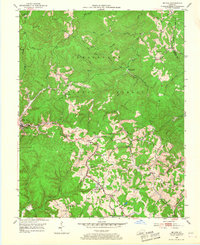
1953 Map of Mc Kee
USGS Topo · Published 1967About this map
Mc Kee serves as the focal point of this 1950s survey of Jackson County, where the topography of the Cumberland National Forest dictates the flow of human settlement. Small communities like New Zion, Gray Hawk, and Atkinstown are scattered along the narrow valley floors and ridgelines, such as Brushy Ridge. The map documents a rural landscape heavily influenced by both natural resources and local institutions, evidenced by the numerous Gas Wells and a Strip Mine in the northwest, contrasted with community anchors like Sparks Sch and Pilgrims Rest Ch. Waterways including War Fork and Pigeon Roost Creek carve through the terrain, creating a complex network of forks and branches that defined travel and property boundaries in this era.
Find a feature on this map
82 named features on this map. Tap any name to fly to it.
Don’t see what you’re looking for? This feature index may not catch every label — zoom into the map to look around manually.
Map Details
Editions of this 1953 Mc Kee Map
3 editions found
Other maps of this area

1891 · Manchester
USGS Topo · 1:125,000

1892 · Richmond
USGS Topo · 1:125,000

1892 · Beattyville
USGS Topo · 1:125,000

1893 · London
USGS Topo · 1:125,000

1897 · Richmond
USGS Topo · 1:125,000

1897 · London
USGS Topo · 1:125,000

1952 · Alcorn
USGS Topo · 1:24,000

1952 · Leighton
USGS Topo · 1:24,000

1952 · Heidelberg
USGS Topo · 1:24,000

1953 · Mc Kee
USGS Topo · 1:24,000