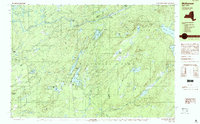
1989 Map of Mc Keever
USGS Topo · Published 1989About this map
The McKeever settlement sits at the confluence of the Moose River and South Br during the late 1980s, serving as a gateway to the central Adirondack Park. This landscape is defined by its seasonal camps and private retreats, such as the Masonic Home Camp on Round Lake and the religious youth facilities at Camp Nazareth and Camp Russell. These sites, along with the Holiday House on Long Lake, illustrate a mid-century tradition of Adirondack summer residency and institutional camping that persists in the deep woods of Forestport and Ohio.
Find a feature on this map
60 named features on this map. Tap any name to fly to it.
Don’t see what you’re looking for? This feature index may not catch every label — zoom into the map to look around manually.
Map Details
Editions of this 1989 Mc Keever Map
This is the sole edition of this map. No revisions or reprints were ever made.
Other maps of this area

1897 · Remsen
USGS Topo · 1:62,500

1900 · Remsen
USGS Topo · 1:62,500

1900 · Wilmurt
USGS Topo · 1:62,500

1901 · Old Forge
USGS Topo · 1:62,500

1902 · Wilmurt
USGS Topo · 1:62,500

1904 · Boonville
USGS Topo · 1:62,500

1905 · Port Leyden
USGS Topo · 1:62,500

1907 · Port Leyden
USGS Topo · 1:62,500

1912 · Mc Keever
USGS Topo · 1:62,500

1940 · Port Leyden
USGS Topo · 1:62,500