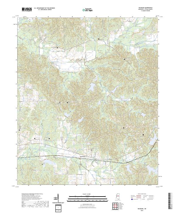
2024 Map of McAdams
USGS Topo · Published 2024About this map
McAdams serves as a central point of reference in this portion of Attala County, where the landscape is defined by the winding paths of Apookta Creek and Long Creek. The area is notably dense with family and community burial grounds, such as Musselwhite Cem, Bethlehem Cem, and Silas Grove Cem, which suggest a long-standing pattern of dispersed rural settlement. These cemeteries, often positioned near local tributaries like Black Branch or Ward Branch, provide critical touchstones for genealogical research in this part of Mississippi. Small bodies of water, including Atwood Lake and Burrel Lake, are interspersed among a network of county roads like Co RD 3015 and Co RD 4202 that connect the various townships and ranges. The drainage pattern, featuring Sharkey Creek and Sugar Creek, highlights the importance of the local watershed to the region's historical agricultural and residential layout.
Find a feature on this map
80 named features on this map. Tap any name to fly to it.
Don’t see what you’re looking for? This feature index may not catch every label — zoom into the map to look around manually.
Map Details
Editions of this 2024 McAdams Map
This is the sole edition of this map. No revisions or reprints were ever made.
Other maps of this area

1953 · Meridian
USGS Topo · 1:250,000

1953 · West Point
USGS Topo · 1:250,000

1957 · Meridian
USGS Topo · 1:250,000

1958 · West Point
USGS Topo · 1:250,000

1962 · Thomastown
USGS Topo · 1:62,500

1963 · West Point
USGS Topo · 1:250,000

1964 · West
USGS Topo · 1:24,000

1964 · Kosciusko NE
USGS Topo · 1:24,000

1964 · Hesterville
USGS Topo · 1:24,000

1964 · Newport
USGS Topo · 1:24,000