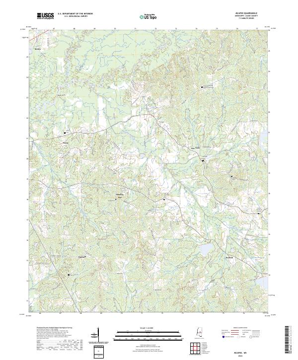
2024 Map of McAfee
USGS Topo · Published 2024About this map
The Pearl River winds through this rural landscape in Leake County, where the settlement of McAfee and the crossing at Boyds Ferry define the northern terrain. This area is characterized by a network of small, dispersed communities including Freeny, Free Trade, and Standing Pine, many of which developed around crossroads and timber resources. The presence of numerous historical burying grounds, such as Galilee Missionary Baptist Church Cem, Hopewell Cem, and Standing Pine Cem, provides a detailed record of the families who settled this region between Lobutcha Creek and Standing Pine Creek. To the south, the village of Estesmill and the community of Rosebud sit among the headwaters of Crowder Creek, reflecting a late-modern landscape still deeply tied to its geographic roots in central Mississippi.
Find a feature on this map
82 named features on this map. Tap any name to fly to it.
Don’t see what you’re looking for? This feature index may not catch every label — zoom into the map to look around manually.
Map Details
Editions of this 2024 McAfee Map
This is the sole edition of this map. No revisions or reprints were ever made.
Other maps of this area

1953 · Meridian
USGS Topo · 1:250,000

1957 · Meridian
USGS Topo · 1:250,000

1961 · Carthage
USGS Topo · 1:62,500

1962 · Edinburg
USGS Topo · 1:62,500

1962 · Thomastown
USGS Topo · 1:62,500

1965 · Meridian
USGS Topo · 1:250,000

1972 · McAfee
USGS Topo · 1:24,000

1972 · Madden
USGS Topo · 1:24,000
1972 · Sebastopol
USGS Topo · 1:24,000
1972 · Walnut Grove
USGS Topo · 1:24,000