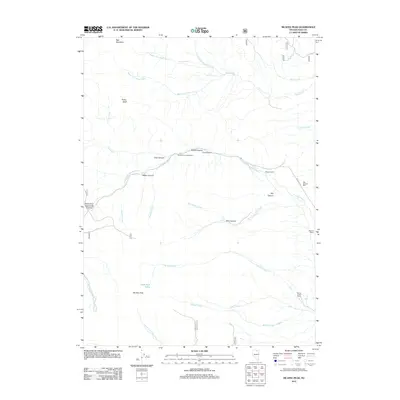
2012 Map of McAfee Peak
USGS Topo · Published 2012About this map
McAfee Peak dominates this high-elevation corner of Elko County, where the headwaters of numerous creeks begin their descent through deep-cut drainages. The landscape is defined by the hydrologic network of the North Fork Humboldt River and its tributaries, including Sammy Creek and Beadles Creek. This 2012 survey illustrates the sparse but vital human footprint in the region, centered on ranching and seasonal recreation. Local ranching history is marked by the presence of Doheny Ranch, Stevens Ranch, and Spring Creek Ranch, while the Big Springs Mill suggests historical resource processing near the canyon floors. High-country access is channeled through points like North Fork Jack Creek Summit and serviced by the Northfork Campgrounds. Small alpine features like Jeannette Lake and various springs provide essential water sources in this arid high-mountain terrain.
Find a feature on this map
42 named features on this map. Tap any name to fly to it.
Don’t see what you’re looking for? This feature index may not catch every label — zoom into the map to look around manually.
Map Details
Editions of this 2012 McAfee Peak Map
This is the sole edition of this map. No revisions or reprints were ever made.
Other maps of this area

1955 · McDermitt
USGS Topo · 1:250,000

1955 · Wells
USGS Topo · 1:250,000

1956 · Tuscarora
USGS Topo · 1:62,500

1956 · Bull Run
USGS Topo · 1:62,500

1956 · Wild Horse
USGS Topo · 1:62,500

1958 · Wells
USGS Topo · 1:250,000

1959 · McDermitt
USGS Topo · 1:250,000

1961 · Wells
USGS Topo · 1:250,000

1971 · North Fork
USGS Topo · 1:24,000

1971 · California Mtn.
USGS Topo · 1:24,000