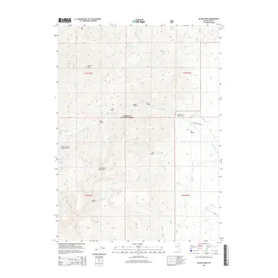
2015 Map of McAfee Peak
USGS Topo · Published 2015About this map
The Independence Mountains define this high-elevation landscape within the Humboldt National Forest. At the center of the terrain is McAfee Peak, the highest point on the sheet, which overlooks the glacial bowl containing Jeannette Lake. Drainage patterns here are complex, with headwaters like McAfee Cr and Walker Cr flowing east, while the N Fork Humboldt River carves through the central portion of the quadrangle. High mountain passes facilitate travel through the range, notably at North Fork Jack Creek Summit, where the Jack Creek Summit Rd traverses the heights. The map reveals a transition from these steep peaks into the broader Valley of the North Fork, illustrating the stark elevation changes common in the Great Basin ranges of Elko County.
Find a feature on this map
39 named features on this map. Tap any name to fly to it.
Don’t see what you’re looking for? This feature index may not catch every label — zoom into the map to look around manually.
Map Details
Editions of this 2015 McAfee Peak Map
This is the sole edition of this map. No revisions or reprints were ever made.
Other maps of this area

1955 · McDermitt
USGS Topo · 1:250,000

1955 · Wells
USGS Topo · 1:250,000

1956 · Tuscarora
USGS Topo · 1:62,500

1956 · Bull Run
USGS Topo · 1:62,500

1956 · Wild Horse
USGS Topo · 1:62,500

1958 · Wells
USGS Topo · 1:250,000

1959 · McDermitt
USGS Topo · 1:250,000

1961 · Wells
USGS Topo · 1:250,000

1971 · North Fork
USGS Topo · 1:24,000

1971 · California Mtn.
USGS Topo · 1:24,000