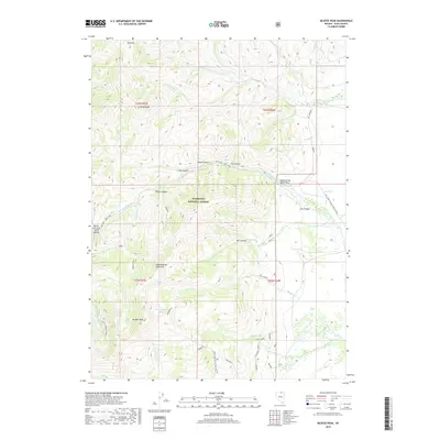
2018 Map of McAfee Peak
USGS Topo · Published 2018About this map
McAfee Peak and the high ridges of the Independence Mountains dominate this high-altitude landscape in northeast Nevada. The terrain is defined by a complex network of canyons and drainages, including Water Canyon, Cole Canyon, and Fry Canyon, which feed into the N Fork Humboldt River. Within the Humboldt National Forest, the map reveals a remote environment characterized by significant elevation changes, from the heights of Red Mtn down to the Valley of the North Fork. Access to this backcountry is marked by a series of specialized routes such as the Dell Loop and Sammy trail. The presence of Jeannette Lake and Big Spring highlights the crucial water sources in this arid montane region, while the North Fork Jack Creek Summit serves as a key topographical transition point.
Find a feature on this map
55 named features on this map. Tap any name to fly to it.
Don’t see what you’re looking for? This feature index may not catch every label — zoom into the map to look around manually.
Map Details
Editions of this 2018 McAfee Peak Map
This is the sole edition of this map. No revisions or reprints were ever made.
Other maps of this area

1955 · McDermitt
USGS Topo · 1:250,000

1955 · Wells
USGS Topo · 1:250,000

1956 · Tuscarora
USGS Topo · 1:62,500

1956 · Bull Run
USGS Topo · 1:62,500

1956 · Wild Horse
USGS Topo · 1:62,500

1958 · Wells
USGS Topo · 1:250,000

1959 · McDermitt
USGS Topo · 1:250,000

1961 · Wells
USGS Topo · 1:250,000

1971 · North Fork
USGS Topo · 1:24,000

1971 · California Mtn.
USGS Topo · 1:24,000